The following are notes that correspond with the slides in the Geography of the Bible presentation. Below each slide one will find the notes corresponding with each slide. This is the opening slide of the presentation. During this slide, the presenter should introduce themselves, and tell the audience why they are presenting and their main thesis: The Old Testament is a book rooted in a physical context. Knowing the importance of the geographical makeup of Old Testament scripture will help one better read and apply the Old Testament writings.
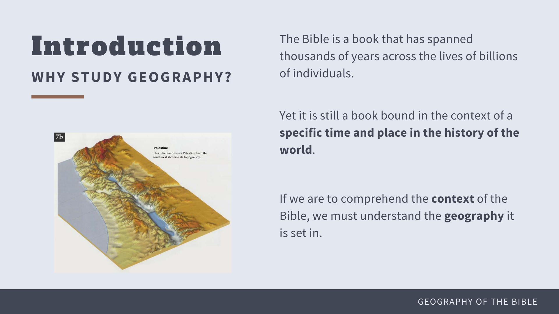
Why Study Biblical Geography?
● The Bible is a book that has spanned thousands of years across the lives of billions of individuals, yet it is still a book bound within the context of a specific time and physical place in the history of the world.
● The stories and teachings contained within its pages are filled with descriptions of places, people and times that are crucial to understanding the writings within.
● If we are to comprehend the context of the Bible, we must understand the geography it is set in.
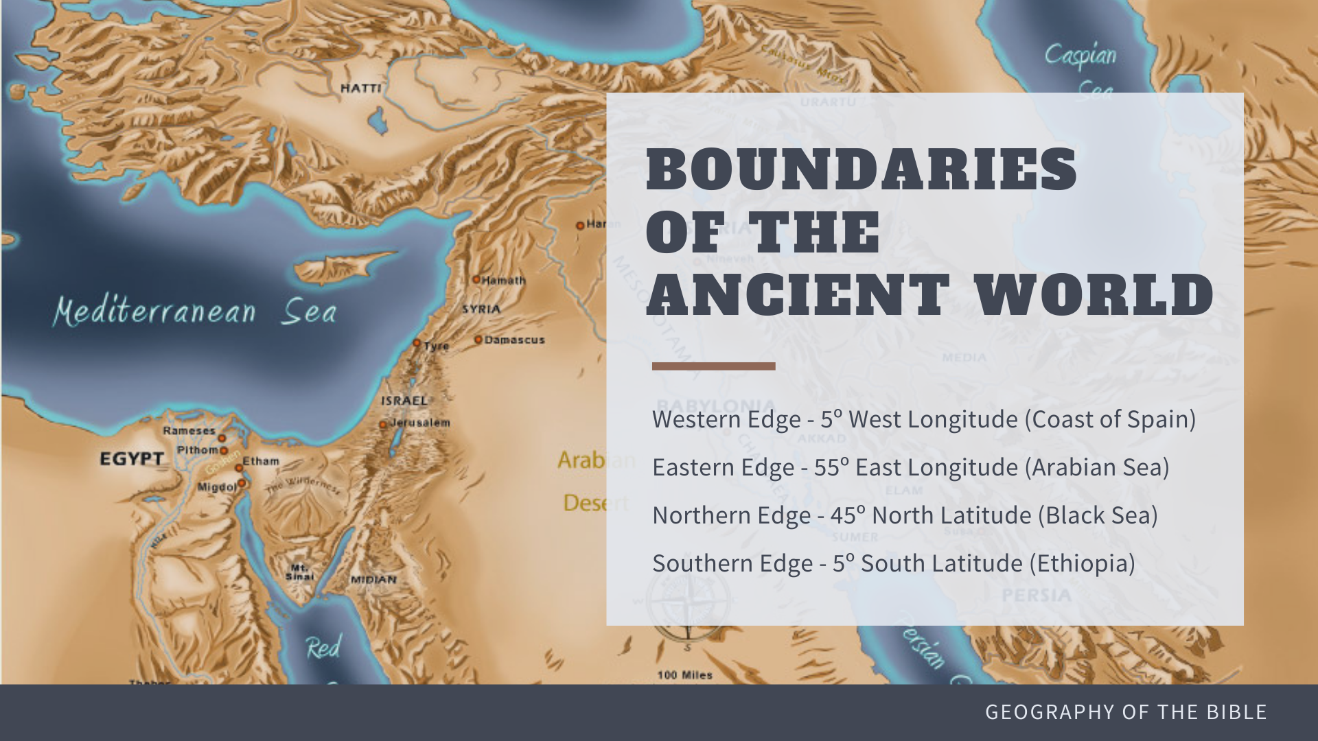
The full width of the Biblical land can be found within the following four boundaries:
● Western Edge: 5° west longitude – Coast of Spain
● Eastern Edge: 55° East Longitude – Arabian Sea
● Northern Edge: 45° North Latitude (Black Sea)
● Southern Edge: 5° South Latitude (Ethiopia)
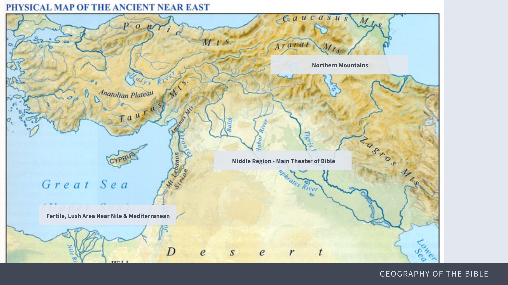
The Ancient Near East can be understood as the intersection of three main regions
● a mountainous border region north of Mesopotamia
○ Where the Bible narrative begins
● the Nile River Delta
○ Think of the Israelite’s travels to Egypt and their subsequent Exodus
● The Syra-African rift between.
○ This area is the main theater of the Biblical narratives.
● The key to this growth of early Bible civilization in the Ancient Near East was the fertile land making a crescent shape over the Euphrates and Tigris rivers in modern-day Iraq, which create an oasis in the midst of a harsh and unforgiving climate.
● Much of the land of the Ancient Near East is rocky and difficult to traverse, let alone
farm for sustainable living.
● However, a key to civilization beginning is found in the area known as the Fertile Crescent
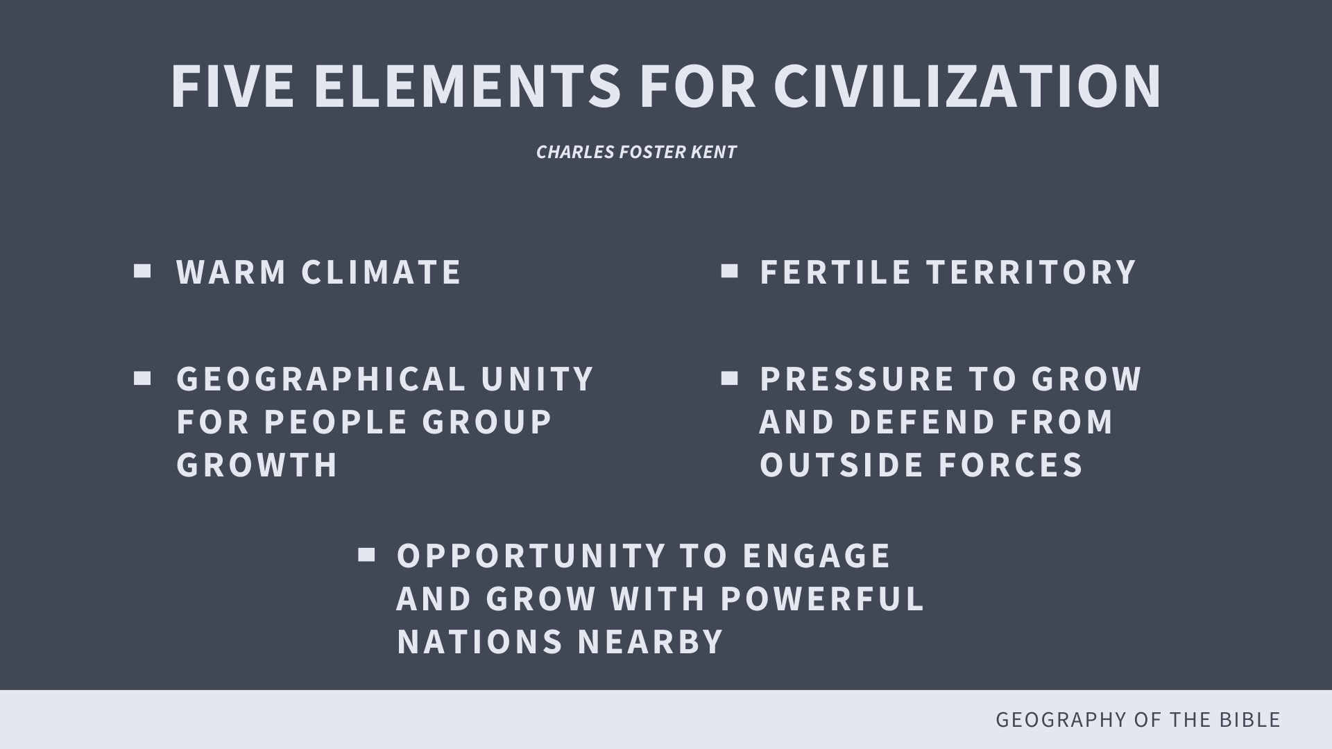
● According to the book Biblical Geography and History by Charles Foster Kent, there were five elements vital to the explosion of civilization in this region:
(1) a warm, but not enervating climate
(2) a fertile and easily cultivated territory
(3) a geographical unity for political and social organization
(4) a pressure from without that encouraged constant activity and effort
(5) an opportunity for expansion and for communication with other nations.
● Based on the above, the region of early Mesopotamia was well-suited for civilization.
● The unforgiving elements in Eastern Arabia and Asia caused nomadic civilizations to travel west to find better lands.
● At the epicenter of these regions is where the Bible tells the story of warring people fighting for resources and land, with the Hebrew people at the center.
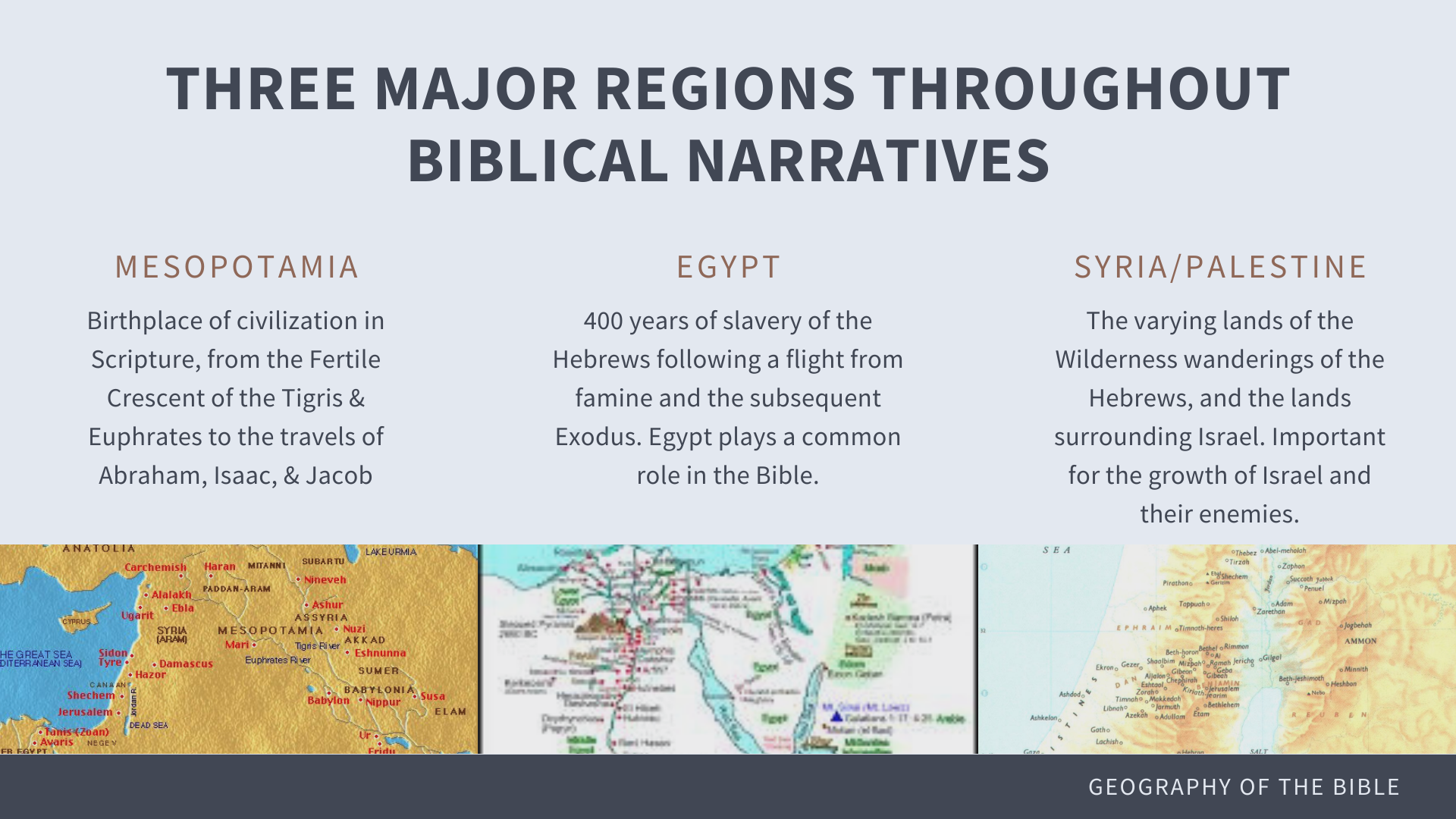
● Through the Old Testament, there are three major regions that appear over and over
○ Mesopotamia
■ Birthplace of civilization in Scripture, from the Fertile Crescent of the Tigris & Euphrates to the travels of Abraham, Isaac & Jacob’s families.
○ Egypt
■ 400 years of slavery of the Hebrews following a flight from famine and the subsequent Exodus. Egypt plays a recurring and common role in the Bible.
○ Syria/Palestine
■ This region encompasses the various wilderness wanderings of the Israelites, as well as the lands surrounding their journey. These contain both the Promised Land and the surrounding nations.
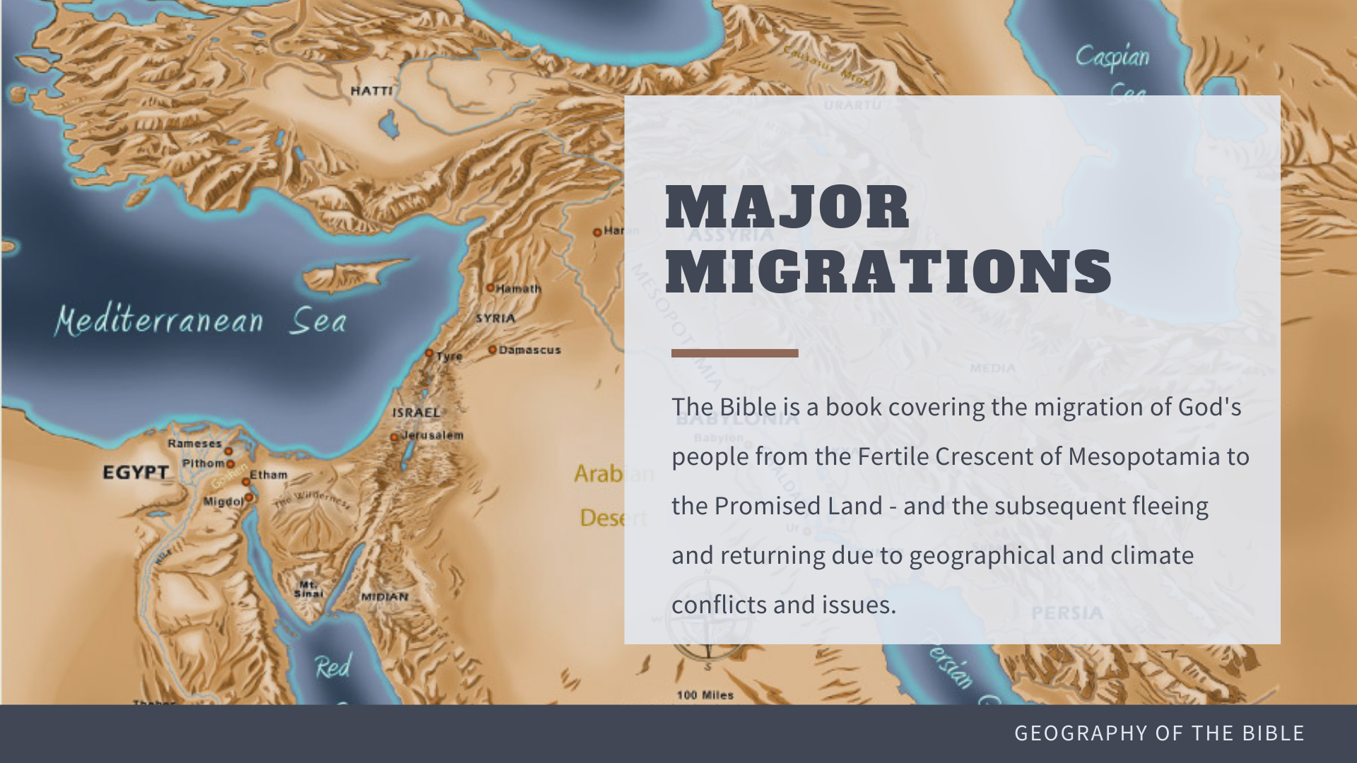
● Not only is the Bible about specific physical locations, but also the traveling of those places by God’s people – the Hebrews.
● The migration across harsh climates led God’s people to question their faith in Him as Lord, but also to return to Him as He leads and provides for them from the earth.
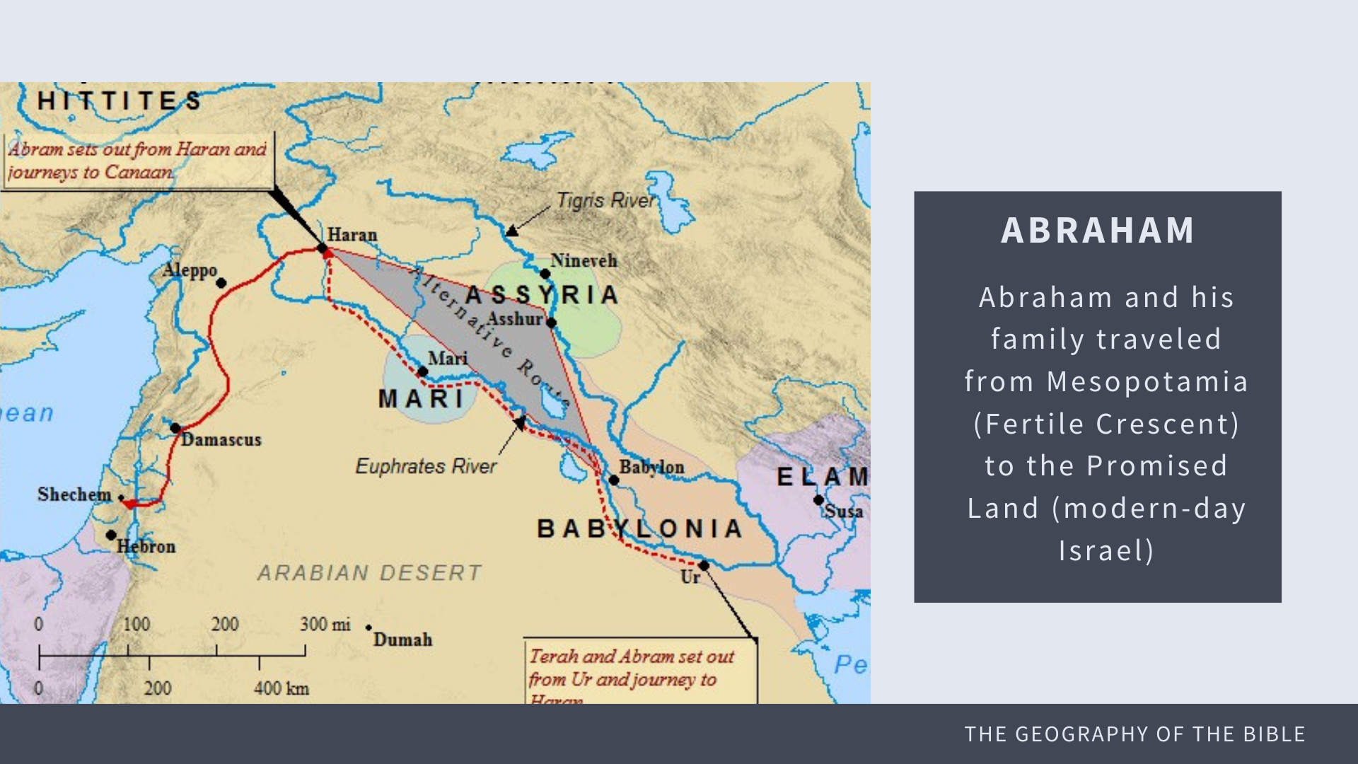
● Example: Abraham’s travels from Mesopotamia/Babylonia (Fertile Crescent area shaded in the image) to the Promised Land (modern-day Israel) following the red line.
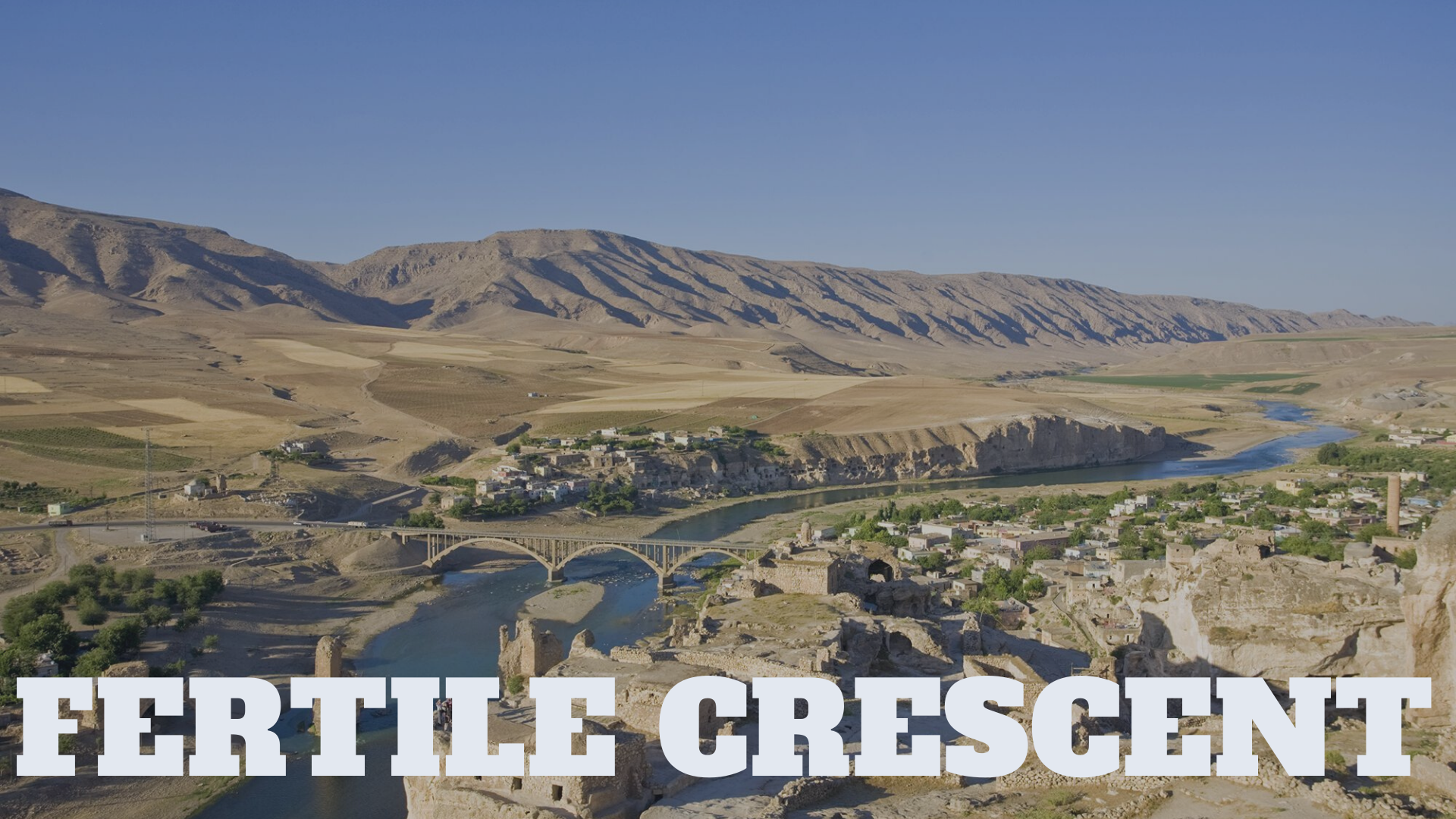
● The Fertile Crescent was an oasis of life in the midst of a harsh, unforgiving desert and mountainous region. The flowing of the Tigris and Euphrates Rivers brought nutrients and water to the surrounding region, leading to civilization to spring up.
● This region is likely where the majority of the early Old Testament migrations occurred.
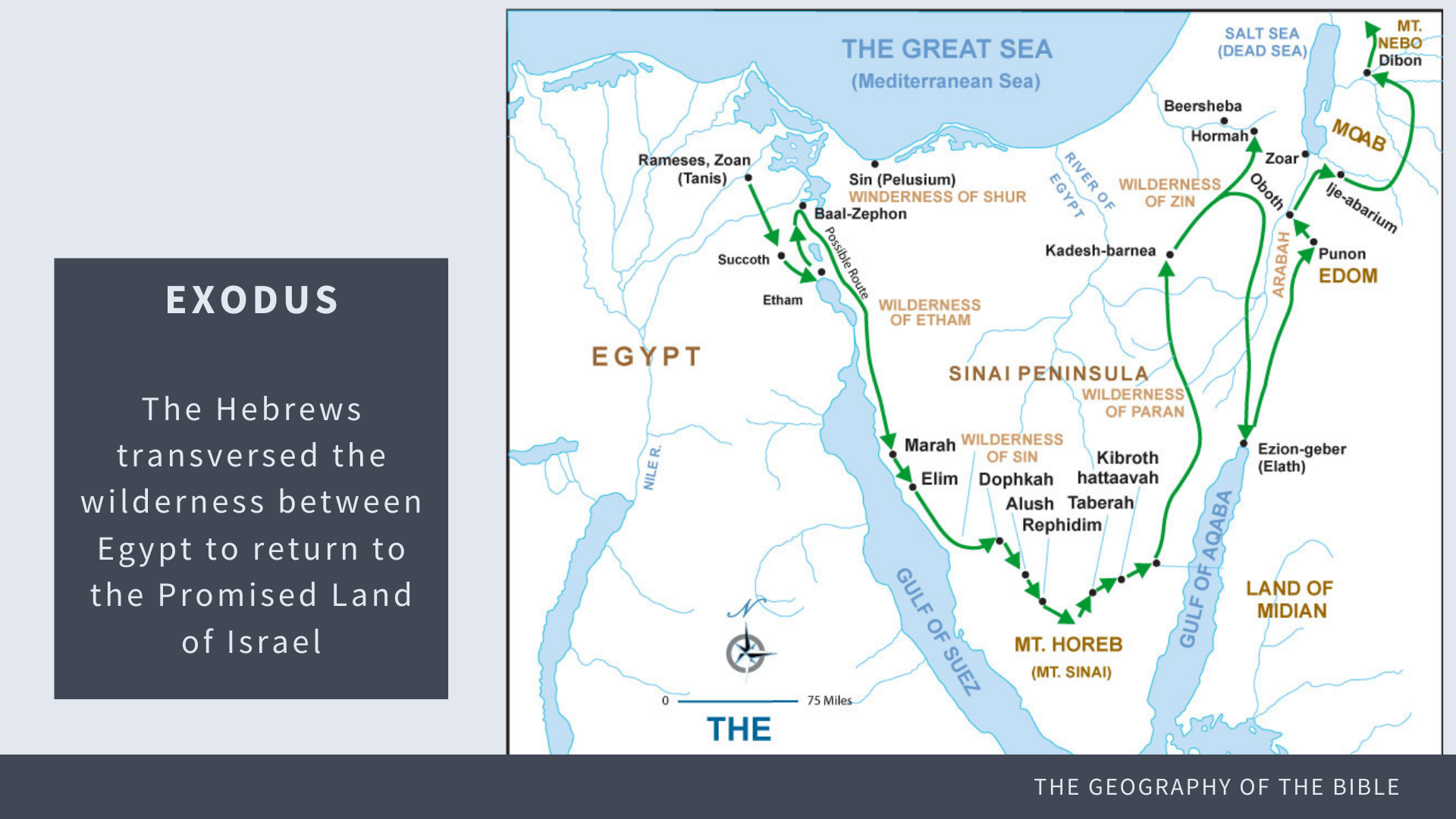
● The Exodus migration found the Hebrew people traversing the wilderness between Egypt to return to the Promised Land of Israel, likely following the green line.
● This journey and the subsequent narratives in the Promised Land include many key geographical locations, as we will see next:
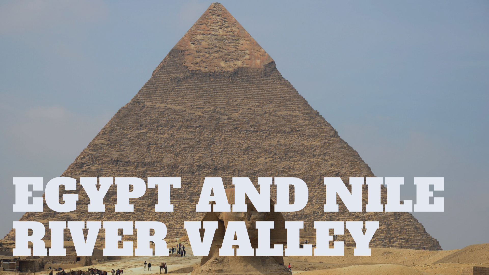
● Egypt and the Nile River Valley play an important role in the Old Testament
● Most known for the destination of Joseph who is sold into slavery by his brothers, and the brother’s subsquent journey there in a time of famine in Syria/Palestine
● Egypt also plays a vital role in the book of Exodus, as the Hebrews become slaves and are forced to work in the brutal desert conditions for Pharaoh.
● With God’s aid, Moses led the Israelites from Egypt, crossing the Red Sea in the Nile Region, and leading the people back toward the Promised Land of Canaan.
● Known for vast deserts and harsh conditions, while also a fertile Nile River Valley similar to the Fertile Crescent of Mesopotamia.
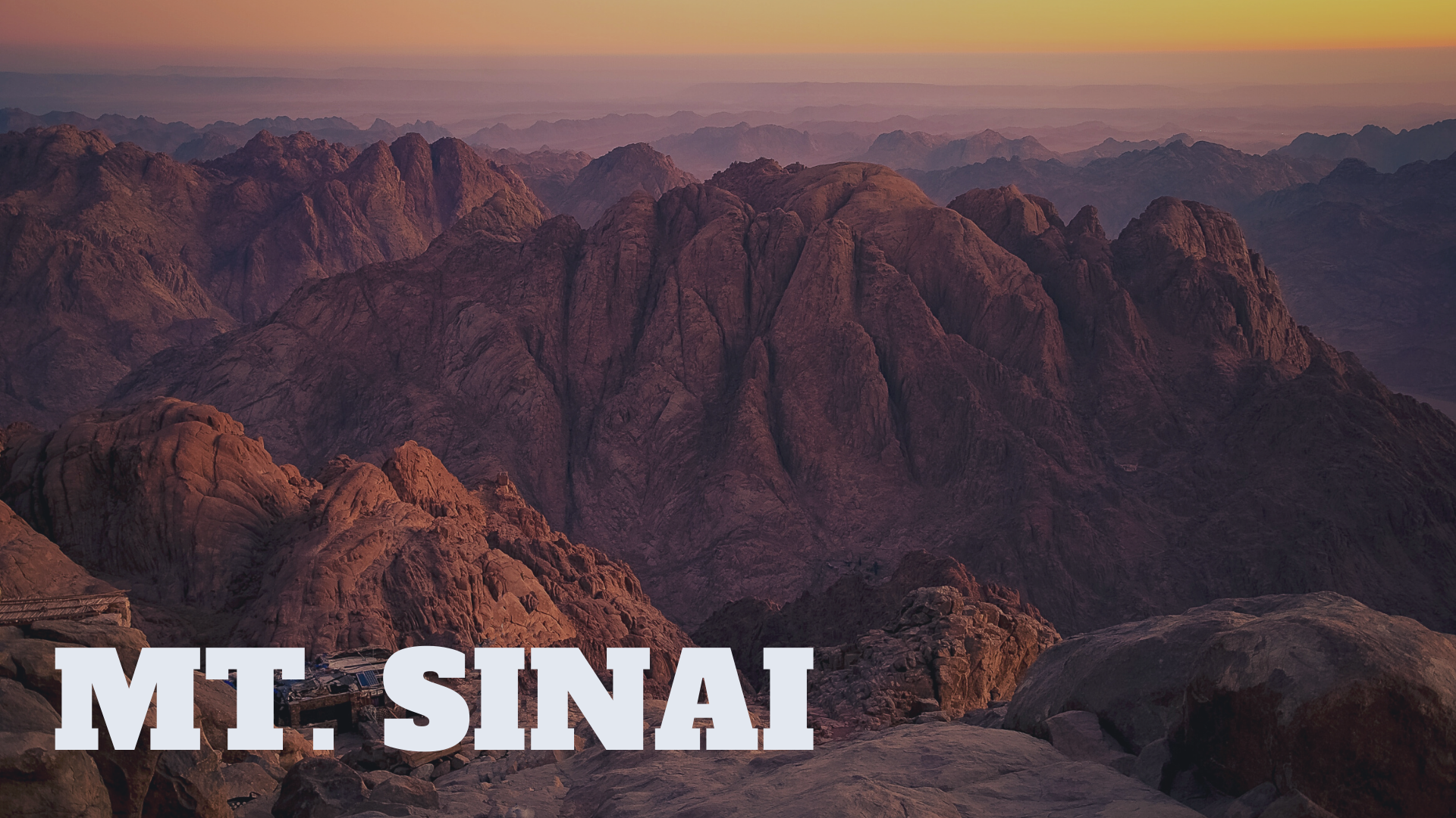
● A 2,285-metre (7,497 ft) moderately high mountain near the city of Saint Catherine in the Sinai region.
● The highest peak in Egypt. It is surrounded on all sides by higher peaks of the mountain range.
● It is on Mt. Sinai that Moses encountered the burning bush, as well as the place where he received the 10 Commandments in Exodus. This holy mountain maintains its significance as the place where God met with man.
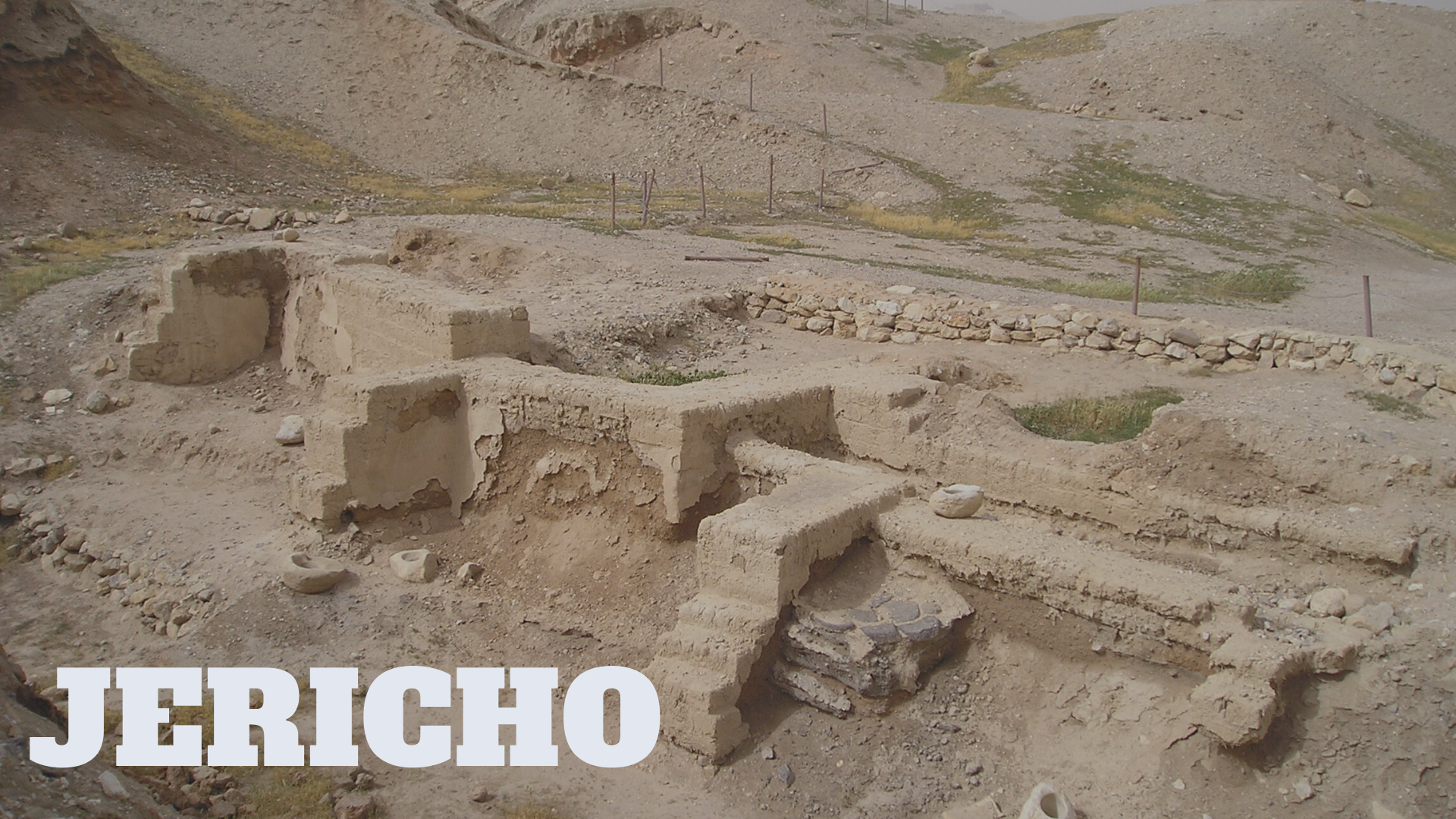
● Located in the Jordan Valley, with the Jordan River to the east and Jerusalem to the west.
● Jericho was the first city that the Israelite encountered and annihilated after crossing the Jordan River.
● Located near the Jordan River, its proximity to water was an important element for its rise and survival.
● The city featured magnificent “walls” that were likely used both for protection from warring tribes as well as protection from floods from the Jordan River. It is these walls that Israel marched around and caused to fall down – leading to the city’s demise.
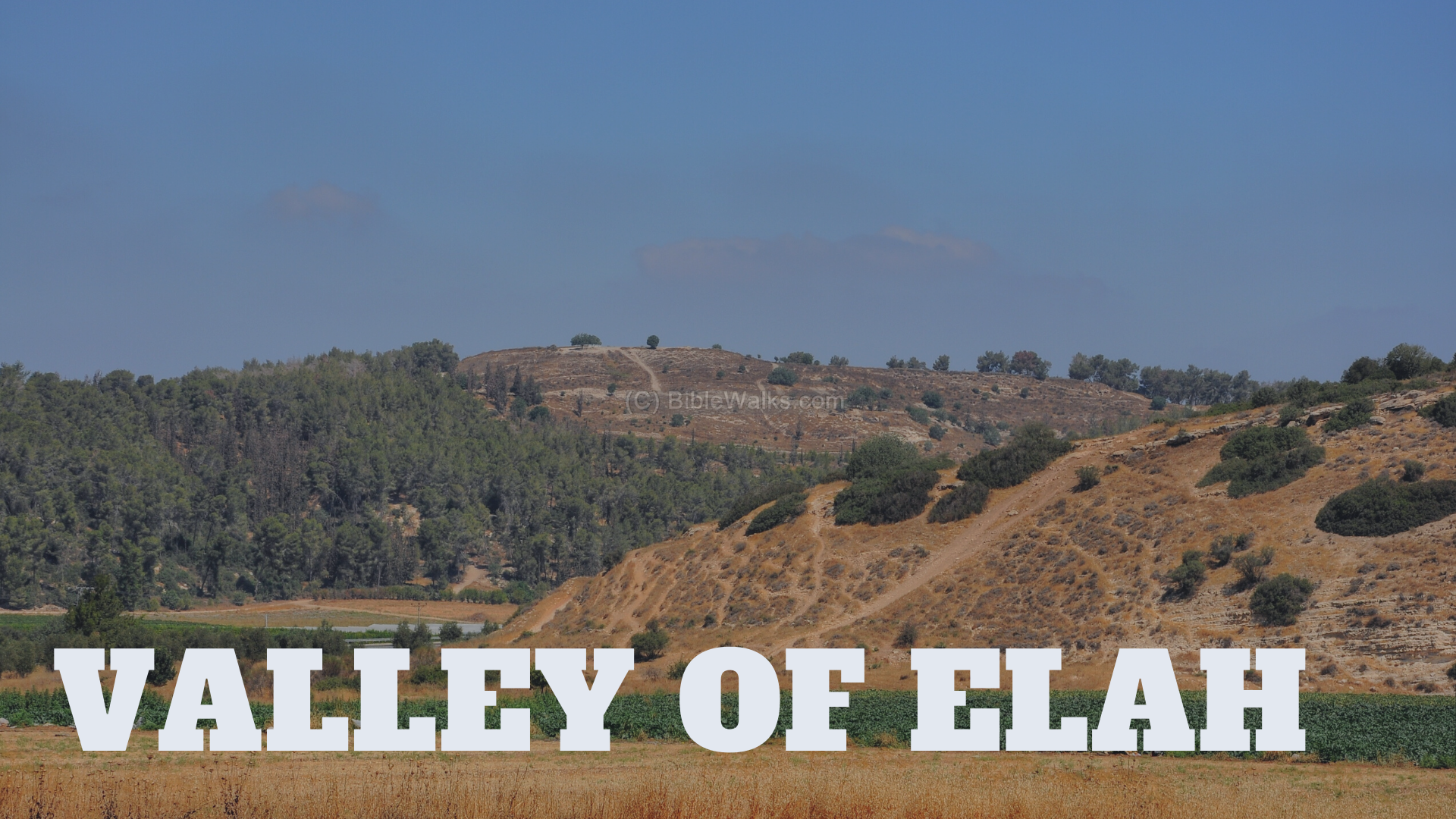
● The Valley of Elah is the likely location where David slew Goliath in 1 Samuel 17. The vast area would have held the armies and camps of Israel and the Philistines.
● It is named after the large and shady terebinth trees which are indigenous to its parts
● While containing vegetation, the ground is rocky and filled with small streams, leading to the narrative of David using “small stones from the stream” to sling at Goliath and kill him.
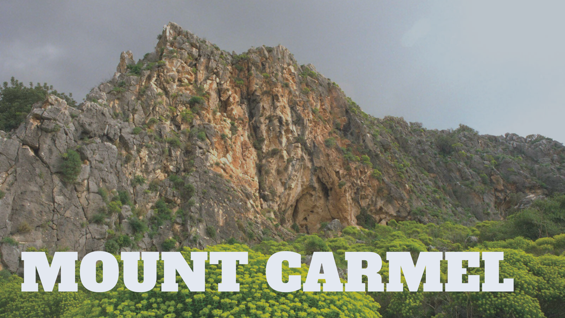
● Mount Carmel is found in part of a coastal mountain range in northern Israel stretching from the Mediterranean Sea towards the southeast.
● The Carmel range is approximately 4 to 5 miles wide, sloping gradually towards the southwest, but forming a steep ridge on the northeastern face 1,791 feet high. The Jezreel Valley lies to the immediate northeast.
● In the Book of Kings, the prophet Elijah challenged 450 prophets of Baal to see whose god would burn a sacrifice. It was from this mountain the fire poured down from heaven to consume Elijah’s offering, as well as the point where Elijah saw a small cloud over the Mediterranean Sea – marking the end of a drought.
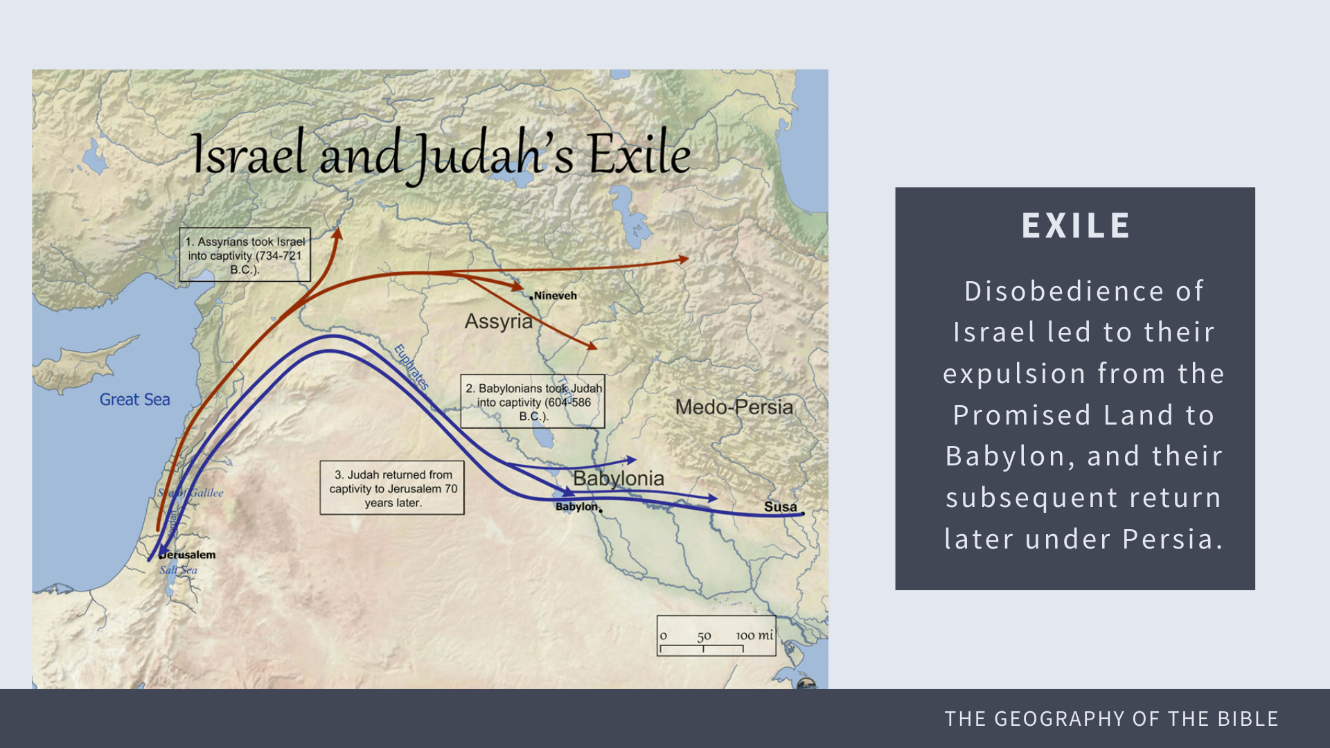
● Following periods of disobedience and evil kings, the people of Israel were conquered by the Babylonian and Persian empires.
● The people were exiled from Israel, and led east toward the capitals located in the Fertile Crescent region of Mesopotamia
● These regions contain several important geographical locations, as will be seen in the following slides:
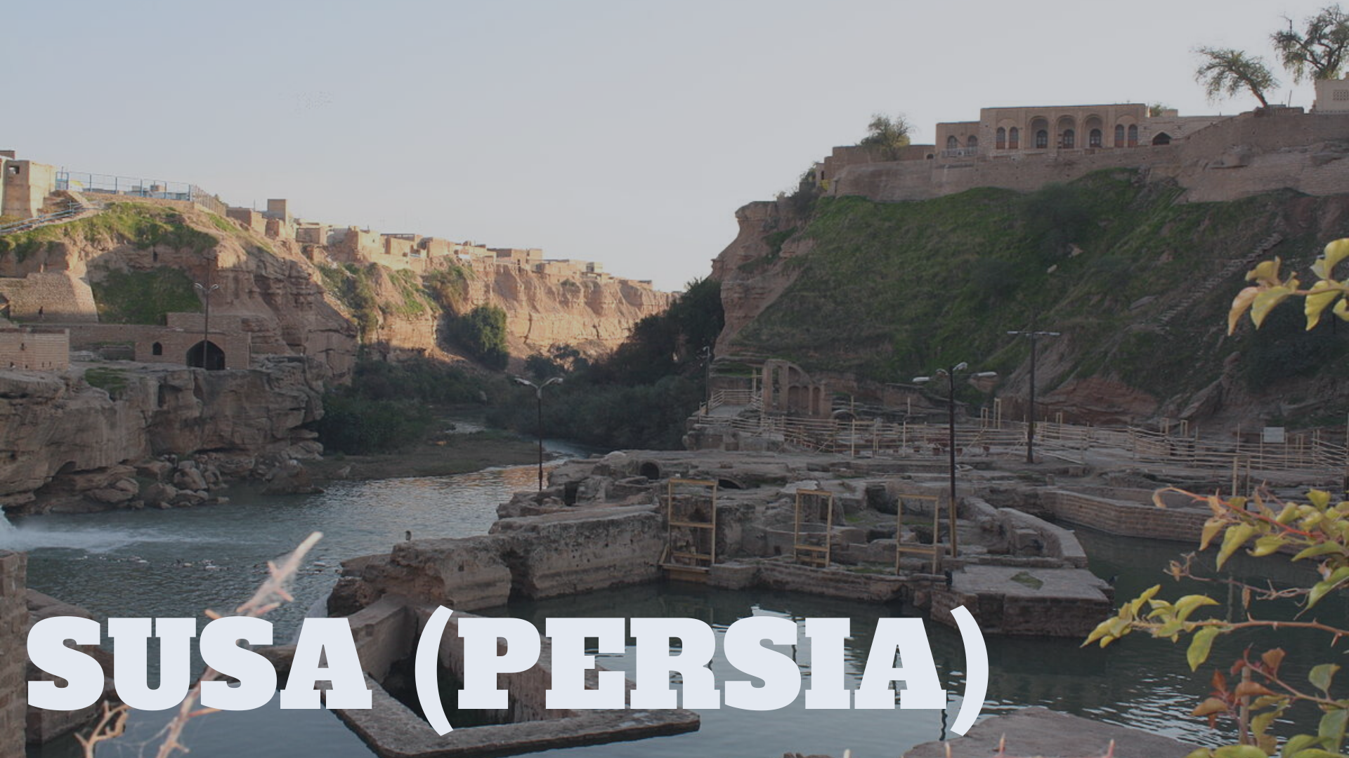
● Susa is an ancient city of the First Persian Empire, now known as modern-day Iran
● one of the most important cities of the Ancient Near East, it was the capital city of the Persian Empire, which overthrew Babylon and with it the Hebrew exiles.
● It is located in the lower Zagros Mountains about 250 km (160 mi) east of the Tigris River, between the Karkheh and Dez Rivers.
● Susa is also the city likely referred to in the book of Esther
● It is from Susa that Nehemiah will return to rebuild the destroyed Jerusalem in Ezra-Nehemiah
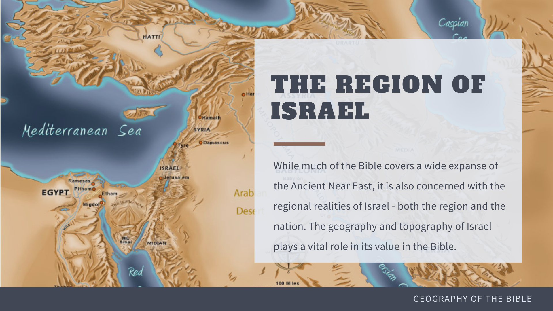
● Though small in size by today’s standards, Israel is the center point of history.
● One cannot separate the geographical reality from the Bible’s clear redemption strategy.
● The geography and topography of Israel plays a vital role in its value in the Biblical narrative, as will be seen in the next series of slides:
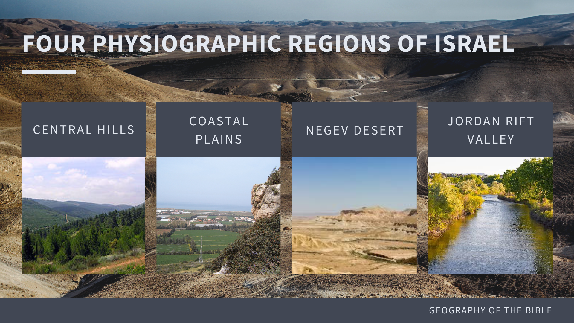
● The region of Israel is made up of four main physiographic regions:
○ the coastal plains
○ the central hills
○ the Jordan rift valley
○ the Negev deserts.
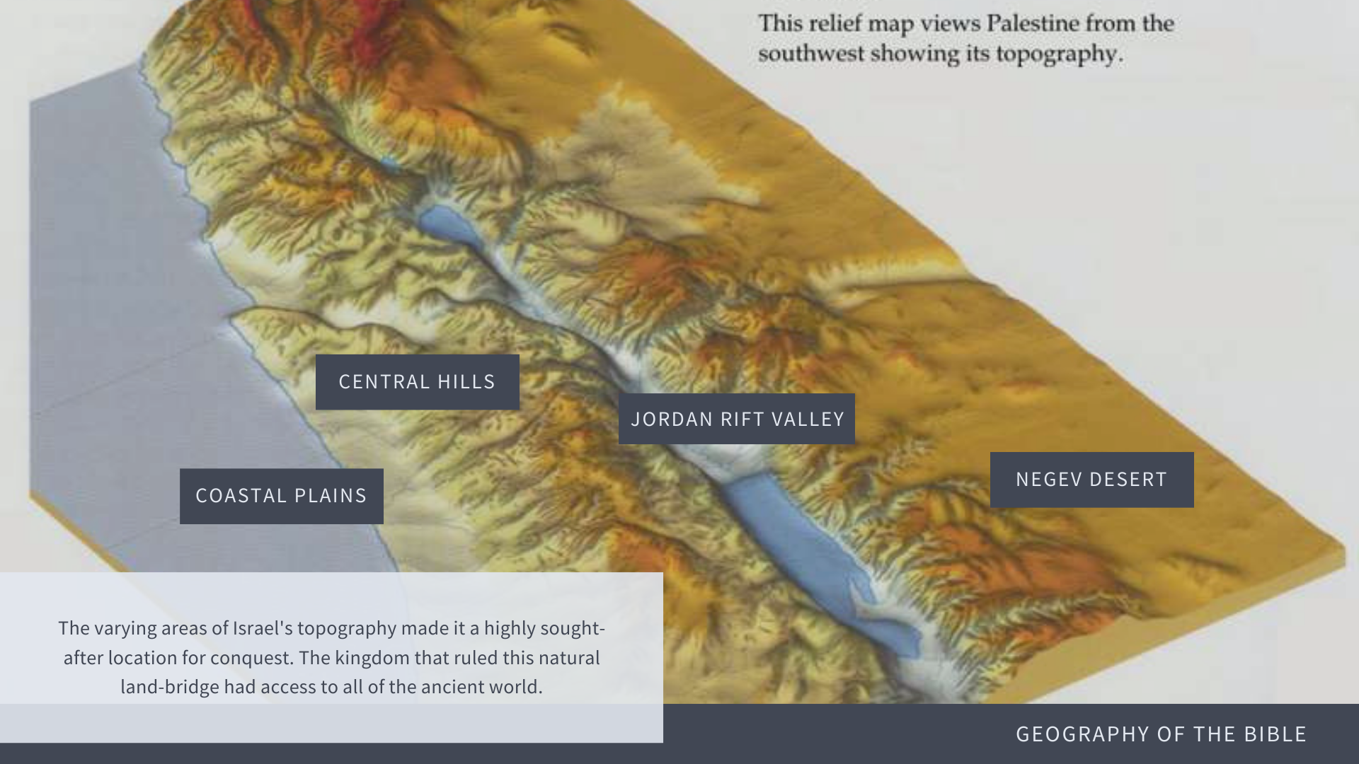
○ The coastal plains are lush and fertile, providing agricultural and economic resources.
○ The Negev desert provides a stark difference and natural defense for Israel, making almost half of the land difficult to traverse and inhabitable.
○ The Jordan rift valley is a prime location for civilization to settle.
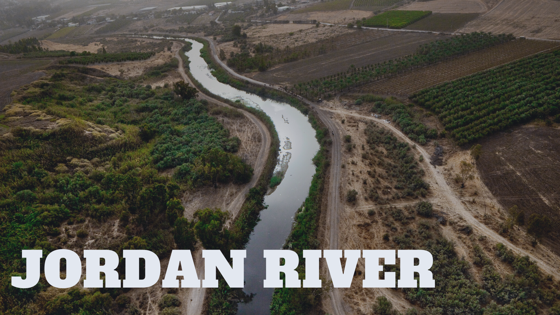
● The Jordan River or River Jordan is a 251-kilometre-long river in the Middle East that flows roughly north to south through the Sea of Galilee and on to the Dead Sea.
● This is the same Jordan that Joshua led the Israelite across in the book of Joshua. Its barrier acted as the final obstacle Israel had to cross to take the Promised Land.
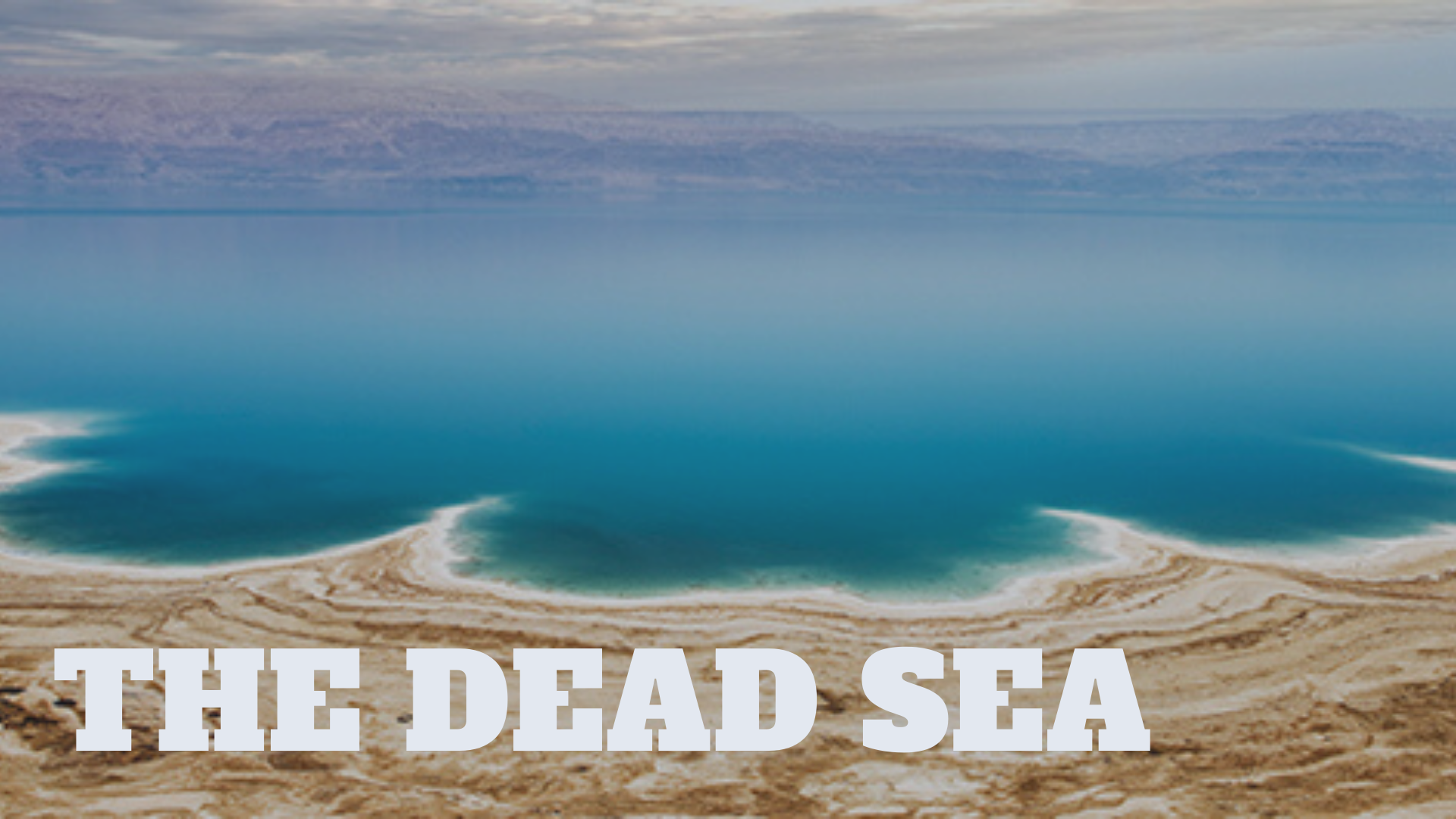
● The Dead Sea – bordering Israel, the West Bank and Jordan – is a salt lake whose banks are more than 400 meters below sea level, the lowest point on dry land.
● Its famously hyper saline water makes floating easy, and its mineral-rich black mud is used for therapeutic and cosmetic treatments at area resorts.
● The surrounding desert offers many oases and historic sites.
● In the prophets, several references are made to the Dead Sea being “made clean” or “made pure” by the holy water that will come from the Temple in the New Jerusalem. This “water” will heal the nations.
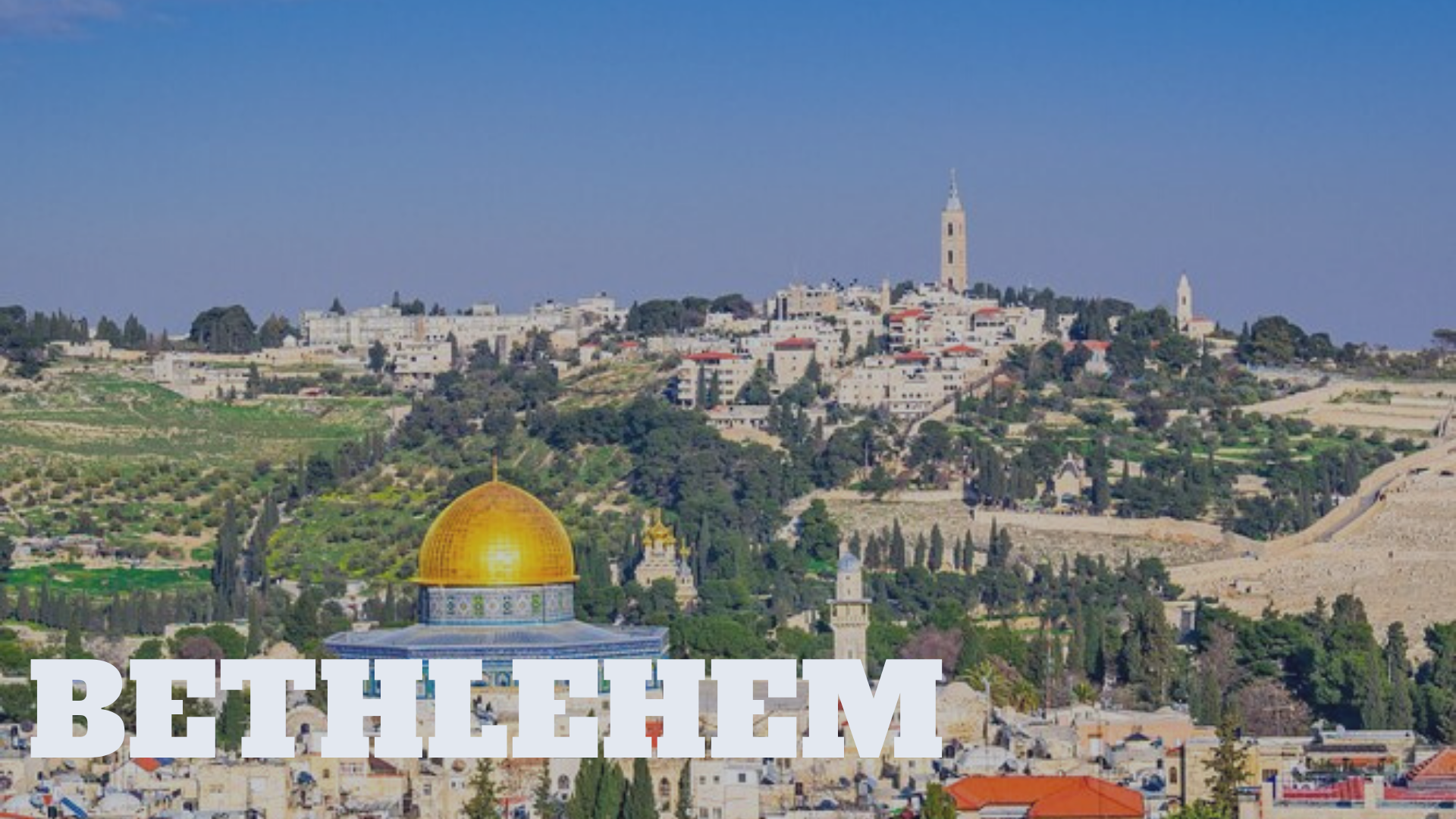
● While Bethlehem is better known as the city where Jesus Christ was born, the small Judean village of Bethlehem exists throughout scripture.
● Most notably, Bethlehem is where Ruth and Naomi returned to after Naomi’s husband dies in Moab and famine comes to the land.
● Boaz, a leader of Bethlehem, shows God’s love in redeeming Ruth and allowing her to survive in Bethlehem – where food is still available.
● Bethlehem would be the place where Jesus was born – and Ruth is a key ancestor of Christ.
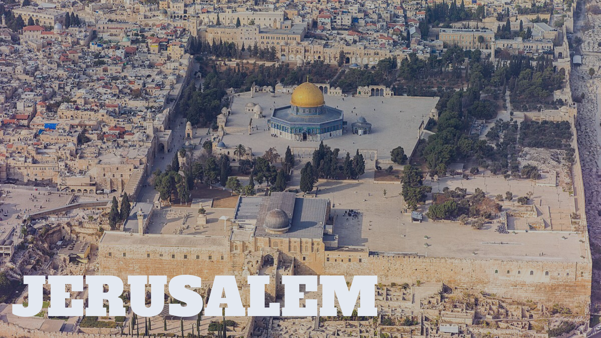
● The main city of the Promised Land – the City of David
● King David set up Jerusalem as a pivotal stronghold of the Israelites.
● The geographical placement of Jerusalem has made it a valuable and sought-after city to this day.
● Though it is a small city by modern standards, it is still vastly important. The people who control Jerusalem both control the land-bridge of major continents, as well as the cultural and religious center of the world!
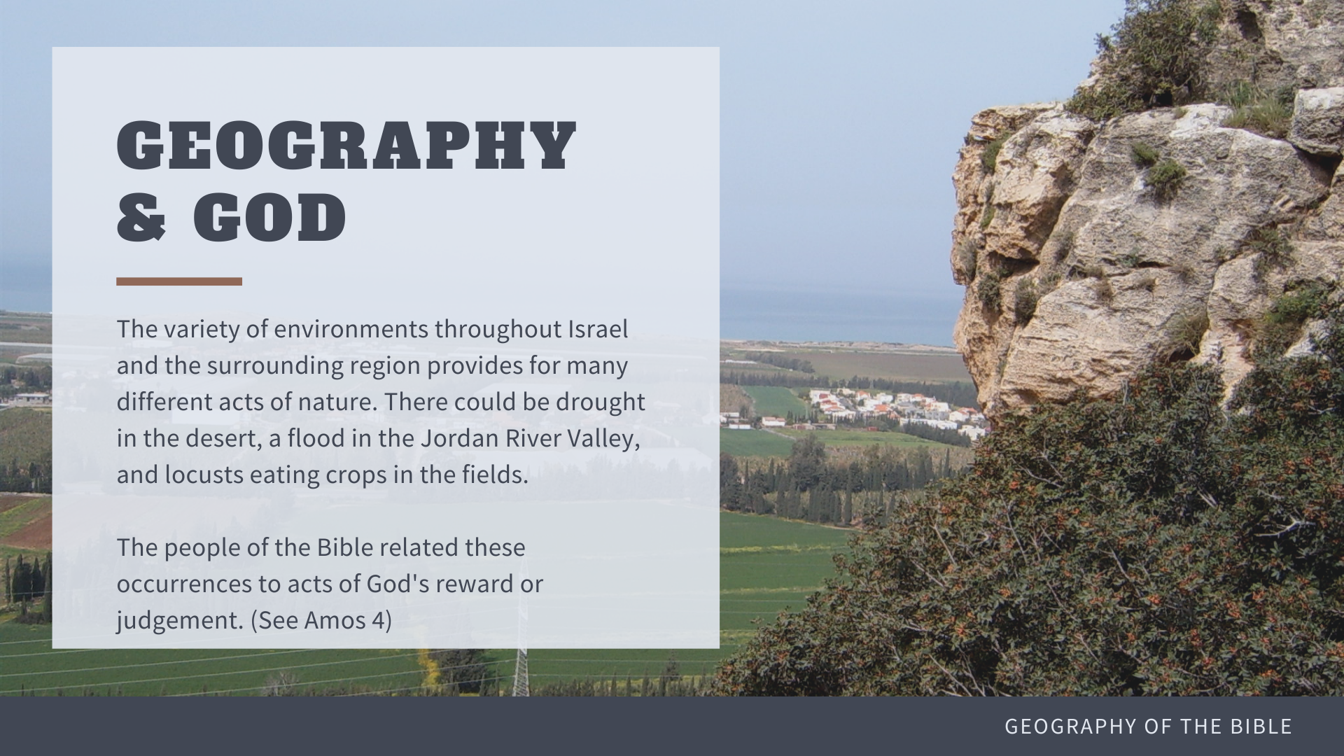
● The variety of climate and topography helps explain the deep connection between the faith of the people living in Israel and the land they inhabited.
○ Water overflowing the banks of the Jordan was seen as a gift from God for the faithfulness of the people.
○ Earthquakes and locusts in the lowlands, as well as threats of war from across the Negev were often seen as judgement.
○ The fourth chapter of Amos shows this connection between geography and deity.
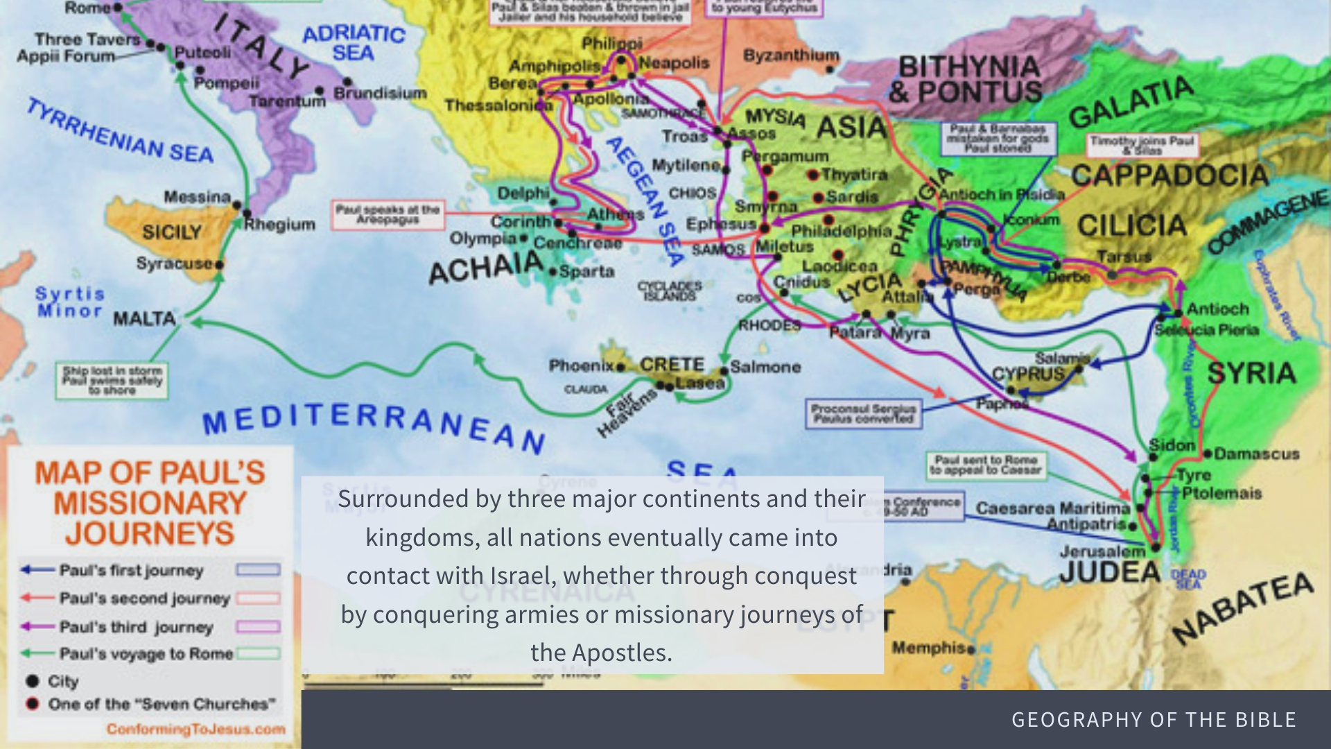
● The location of Israel geographically was also key to the proliferation of Christianity.
● As a strategic land connection between major continents, God’s placement of Israel at the center of the world was a strategic move for taking the hope of the Gospel to the ends of the earth.
● Proper knowledge of God’s geopolitical set-up allows for a greater appreciation of how Israel was truly to be the hope of the world.
○ As the only active land bridge between Asia and Africa, the Israelites had the opportunity to display God’s power and glory to the nations.
● Similarly, studying Biblical geography opens one’s eyes to the reality of scripture’s accuracy.
○ Biblical historian Karen Engle writes, “The accuracy of geographical information in the biblical accounts… would have been hard to fake. There were no atlases, only eyewitness accounts documented by the Bible’s ancient writers.”
● Knowing Biblical geography helps you better interpret God’s Word
○ The context of scripture matters! Knowing how to connect Scripture to the world it’s authors inhabited brings the Word to life!
○ This is shown by a quote from historian B.J. Beitzel in the next slide.
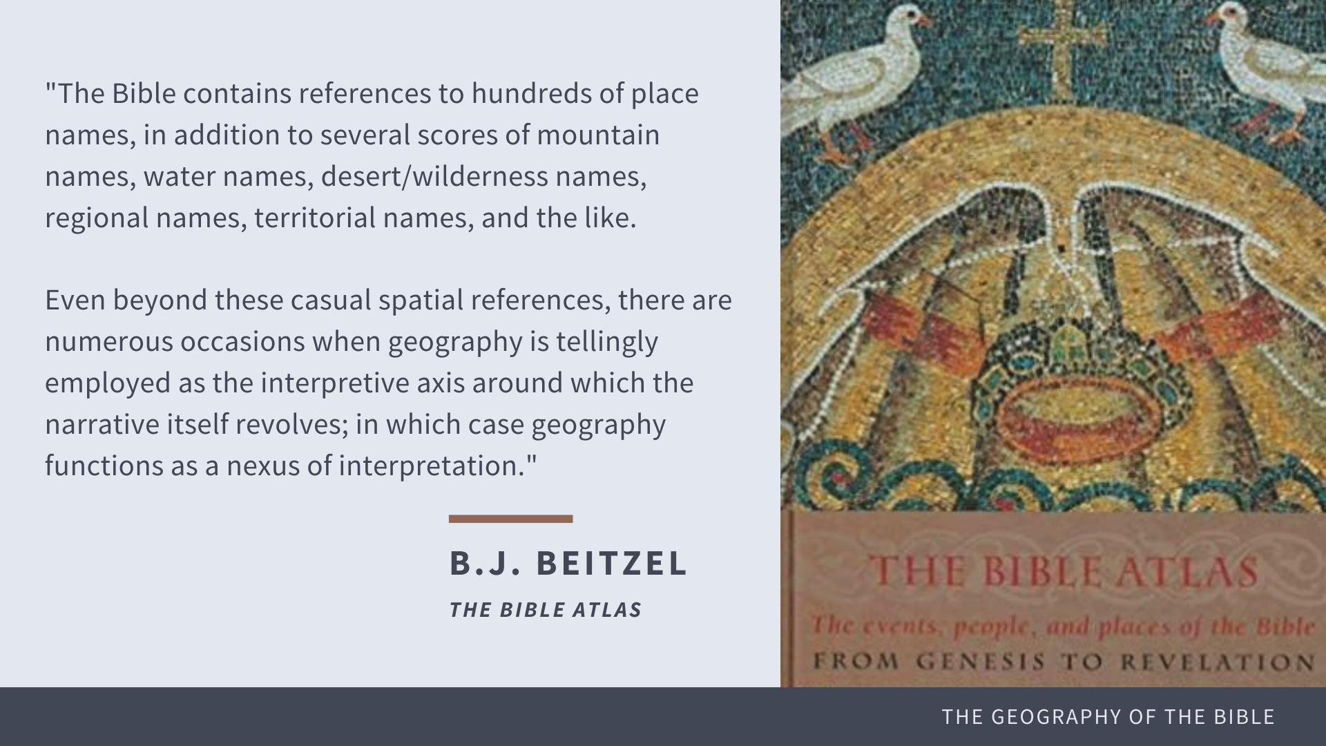
● A proper understanding of Biblical geography helps the interpretation of God’s Word.
● Historian B.J. Beitzel writes:
…there are numerous occasions when geography is tellingly employed as the interpretive axis around which the narrative itself revolves; in which case geography functions as a nexus of interpretation.
● This final slide provides time to wrap up presentation and speak on the sources used for the creation of the project.
Source: Genesis University